THE CUBE ENVIRONMENT
The Landscape
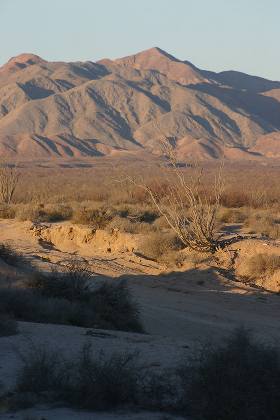
[above] The foothills of the Sierra de San Pedro Mátir rising from the desert a few miles West of the Cube
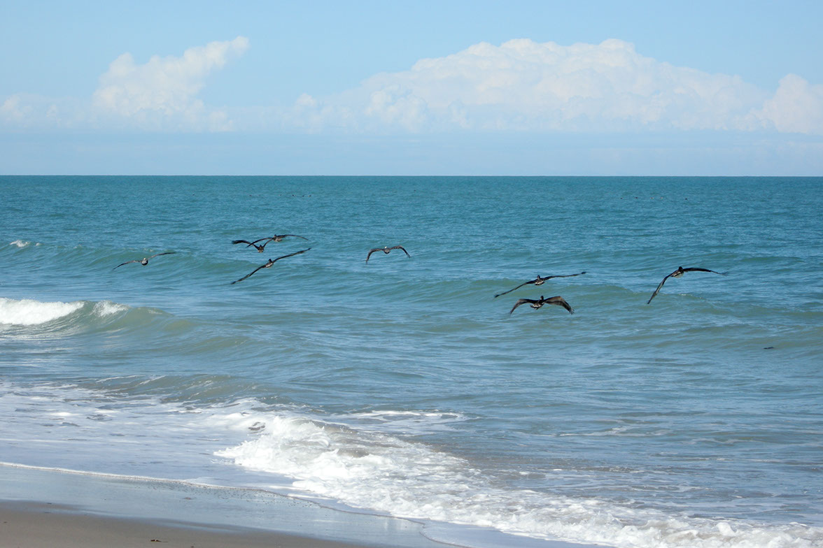
[below] Pelicans swoop over the shoreline outside the Cube
The Mountains About three miles to the West of the Cube a range of mountains arises from the desert floor. These are the foothills of the Sierra de San Pedro Mátir (Saint Peter the Martyr) range which forms the backbone of the Baja California peninsula. The highest peak of this mountain range, Piacho del Diablo (Devil's Peak) is clearly visible form the Cube to the Northwest, especially at sunset. Rising to 10,147 feet, Diablo is actually the highest point in Baja California.
 The mountains were formed by ancient volcanic activity far below the surface. As the rocks cooled they were slowly uplifted by tectonic forces to their current elevation. They consist primarily of igneous rock, including various types of granite. Several lateral spurs of these mountains run West to East between San Felipe and Puertecitos and are the reason for some dramatic zig-zags in highway 5 South of San Felipe. Dark greyish brown in color, they are mostly devoid of vegetation in the lower elevations. Their salience varies by time of day. At dawn the shapes of the hills are seen in stark contrast defined by the shadows cast by the low angle of the sun, and bathed in a golden light. At noon they seem to disappear into the sky in a matching tone of blue, and at sunset they appear in dark echelons embedded in layers of yellow mist.
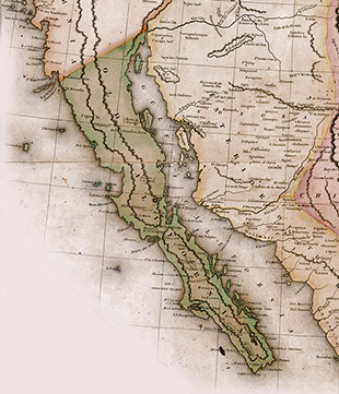
The Sea The Sea of Cortez, also known as the Gulf of California has an interesting origin. A glance at the map will show that its length and width are almost a mirror image of the peninsula itself. The sea is essentially a flooded valley whose axis aligns with the San Andreas Fault, and is, in fact, an continuation of the same fault system. About 20 million years ago this crack began to widen and a peninsula was formed. Geologists tell us that Baja California and the entire West coast of California are slowly moving Northwest and will eventually disappear under the Aleutian Islands in Alaska!
The delta of the Colorado River forms the North end of the sea. Not much water enters from this source since almost all of it will have been siphoned off by San Diego before it can reach the sea. But silt from the delta affects the clarity of the water which is relatively cloudy at the Cube compared to the waters near Cabo San Lucas.
The Sierra de San Pedro Mátir mountain range shown in an old map of Baja Califorina
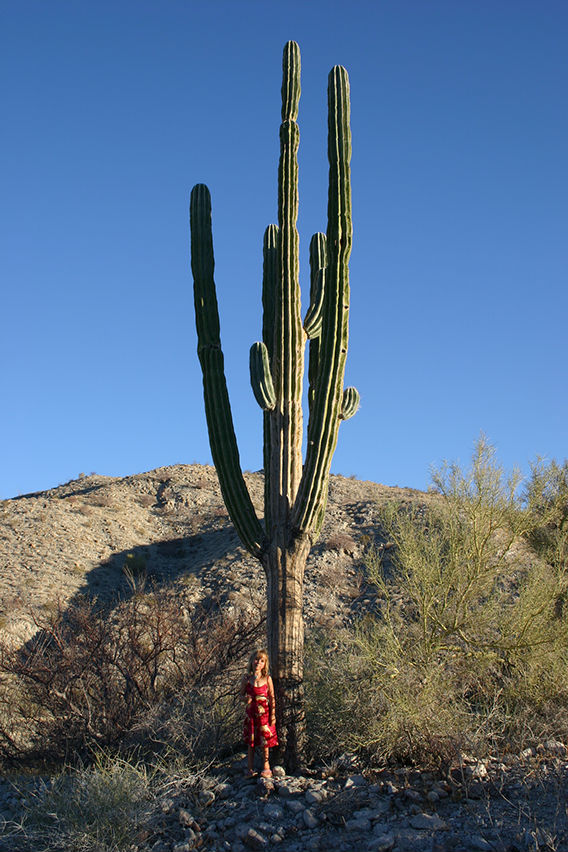
Anna stands before a cardón in the desert West of the Cube
The Desert Much of the East coast of Baja California is desert, part of a corridor of desert landscapes which stretches from the Anza Borrego desert at the base of the Laguna Mountains in California, and continues through the Yuha desert North of Calexico and the San Felipe desert which begins at the army checkpoint at a place known as El Chinero.
The desert in the area of the Cube is particularly rich and varied with many types of cactus and brush forming a thin but persistent carpet over the sandy soil. (See this section of the website for a more detailed description of the desert vegetation.) The stark simplicity of the desert landscape induces a feeling of tranquility unmatched by other types of terrains. Hiking the many trails into the desert is enjoyable, but we do advise bringing water with you.
Following the trail West of the cube, up to the base of the mountains, you will find outcrops of rock containing fossils, including fossil clams. The surrounding desert contain a few secrets and surprises including a hidden waterfall where an underground river emerges, fed with rain-water from the plateau far to the West.
The Human Landscape Apart from the highway and the ribbon of beach houses the impact of humans on the landscape is minimal, which is fortunate because when it is apparent it is not always attractive.
CAMPO CADENA
Campo Cadena, where the Cube was built, was a part of what is called Ejido land. This is land which was distributed to the poor people of Mexico shortly after the end of the last revolution. The Ejido system was used in the late 1600s and was re-initiated after the Mexican Revolution in some states but the repartition of land in most of Mexico did not begin until Lázaro Cárdenas became president in 1934. The Ejido system was introduced as an important component of the land reform program. Ejidatarios do not actually own the land, but are allowed to use their alloted parcels indefinitely as long as they do not fail to use the land for more than two years. They can even pass their rights on to their children. Mauñel Cadena was granted Ejido land but decided to buy his alloted parcel of land in the mid 1900s. Campo Cadena is actually many square miles that run from the Sea of Cortez all the way past the first ridge of the mountains on the horizon in the West.